
ISBN: 9781566953054
• Waterproof • Tear-Resistant • Topographic MapA popular destination for mountain biking, hiking, whitewater rafting, and four-wheeling, Moab offers adventure and recreatio… Altro …
| BarnesandNoble.com new in stock. Costi di spedizione:zzgl. Versandkosten., Costi di spedizione aggiuntivi Details... |

2009, ISBN: 9781566953054
This detailed recreation map contains carefully researched trails, campsites, BLM roads, The Colorado River Way area and Colorado River mileages, Green River mileages, Fisher Towers, and … Altro …
| Orellfuessli.ch Nr. 17644655. Costi di spedizione:Lieferzeiten außerhalb der Schweiz 3 bis 21 Werktage, , Versandfertig innert 6 - 9 Werktagen, zzgl. Versandkosten. (EUR 17.04) Details... |
2011, ISBN: 9781566953054
This detailed recreation map contains carefully researched trails, campsites, BLM roads, The Colorado River Way area and Colorado River mileages, Green River mileages, Fisher Towers, and … Altro …
| Orellfuessli.ch Nr. 17644655. Costi di spedizione:, Versandfertig innert 1 - 2 Wochen, zzgl. Versandkosten. (EUR 16.92) Details... |

ISBN: 9781566953054
National Geographic's Trails Illustrated Maps are the most detailed and up-to-date topographic recreation maps available for US National Parks, National Forests and other popular outdoor … Altro …
| wordery.com Nr. Costi di spedizione:, , zzgl. Versandkosten., Costi di spedizione aggiuntivi Details... |

2012, ISBN: 9781566953054
Trails Illustrated Other Rec. Areas, Karte/Globus, Karte (gefalzt), 2020th ed. [PU: National Geographic Maps], National Geographic Maps, 2012
| lehmanns.de Costi di spedizione:Versand in 7-10 Tagen. (EUR 0.00) Details... |

ISBN: 9781566953054
• Waterproof • Tear-Resistant • Topographic MapA popular destination for mountain biking, hiking, whitewater rafting, and four-wheeling, Moab offers adventure and recreatio… Altro …


2009, ISBN: 9781566953054
This detailed recreation map contains carefully researched trails, campsites, BLM roads, The Colorado River Way area and Colorado River mileages, Green River mileages, Fisher Towers, and … Altro …
2011
ISBN: 9781566953054
This detailed recreation map contains carefully researched trails, campsites, BLM roads, The Colorado River Way area and Colorado River mileages, Green River mileages, Fisher Towers, and … Altro …

ISBN: 9781566953054
National Geographic's Trails Illustrated Maps are the most detailed and up-to-date topographic recreation maps available for US National Parks, National Forests and other popular outdoor … Altro …
2012, ISBN: 9781566953054
Trails Illustrated Other Rec. Areas, Karte/Globus, Karte (gefalzt), 2020th ed. [PU: National Geographic Maps], National Geographic Maps, 2012
Dati bibliografici del miglior libro corrispondente

| Autore: | |
| Titolo: | |
| ISBN: |
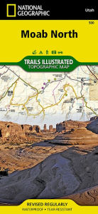
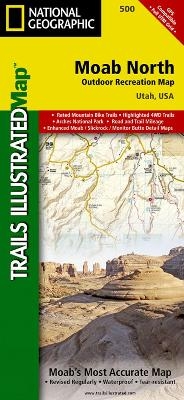
• Waterproof • Tear-Resistant • Topographic Map
A popular destination for mountain biking, hiking, whitewater rafting, and four-wheeling, Moab offers adventure and recreation in one of the most iconic landscapes in the United States. National Geographic's Trails Illustrated map of Moab North was created in partnership with local land management agencies to provide unmatched detail of the area and useful information to help you get the most from your visit. The print map includes an inset of Monitor & Merrimac Buttes / Sovereign Trail and Moab / Slickrock areas, as well as additional detail of the following three regions: Monitor & Merrimac Buttes / Bartlett Wash / Sovereign Trail; Moab / Slickrock / Porcupine Rim; and Green River and Tenmile Point. Other areas of interest featured on this map include Arches National Park, Professor Valley, Fisher Towers, and Dewey Bridge.
Particular attention is shown to the extensive trail systems in the area. Information on mountain bike and Jeep trails includes their difficulty rating, mileage, and location. A listing of popular hiking-only trails is included, and the western portion of Kokopelli's Trail that traverses the region is highlighted. The clearly marked trails include trail use and mileages between intersections. River mileage on the Colorado and Green rivers is noted as well, for those exploring by boat. Biker and desert safety tips are offered and recreation features such as campgrounds, trailheads, river access, boat launches, interpretive trails, and scenic overlooks are noted. The map base includes contour lines and elevations for summits and passes.
Every Trails Illustrated map is printed on "Backcountry Tough" waterproof, tear-resistant paper. A full UTM grid is printed on the map to aid with GPS navigation.
Other features found on this map include: Arches National Park, Dolores River, Manti-La Sal National Forest, Salt Valley.
Map Scale = 1:70,000 & 1:35,000Sheet Size = 37.75" x 25.5"Folded Size = 4.25" x 9.25"Informazioni dettagliate del libro - Moab North
EAN (ISBN-13): 9781566953054
ISBN (ISBN-10): 1566953057
Copertina rigida
Anno di pubblicazione: 2009
Editore: National Geographic Maps
Peso: 0,093 kg
Lingua: eng/Englisch
Libro nella banca dati dal 2011-04-21T14:28:06+02:00 (Zurich)
Pagina di dettaglio ultima modifica in 2022-02-19T11:48:48+01:00 (Zurich)
ISBN/EAN: 9781566953054
ISBN - Stili di scrittura alternativi:
1-56695-305-7, 978-1-56695-305-4
Stili di scrittura alternativi e concetti di ricerca simili:
Autore del libro : national geographic maps
Titolo del libro: national geographic, moa, usa, utah, north
Dati dell'editore
Titolo: Moab North - NATIONAL GEOGRAPHIC Trails Illustrated Utah
Editore: National Geographic Maps
Lingua: Inglese
9,99 € (DE)
10,30 € (AT)
Not available (reason unspecified)
CB; GEF; Karten, Globen / Reisen/Karten, Stadtpläne, Atlanten/Nordamerika, Mittelamerika; Landkarten und Atlanten; Nordamerika (USA und Kanada)
Altri libri che potrebbero essere simili a questo:
Ultimo libro simile:
0749717009585 Gunnison / Pitkin: National Geographic Trails Illustrated Colorado (National Geographic Trails Illustrated Map, Band 132) (National Geographic Maps)
- 0749717009585 Gunnison / Pitkin: National Geographic Trails Illustrated Colorado (National Geographic Trails Illustrated Map, Band 132) (National Geographic Maps)
- 0749717009448 Walden / Gould: NATIONAL GEOGRAPHIC Trails Illustrated Colorado (National Geographic Trails Illustrated Map, Band 114) (National Geographic Maps)
- 0749717009547 Maroon Bells/Redstone/Marble : Trails Illustrated: 128 (National Geographic Maps: Trails Illustrated) (National Geographic Maps)
< Per archiviare...