ESEMPIO
National Geographic Maps:La Garita/cochetopa: Trails Illustrated (Paperback)
- edizione con copertina flessibile 2019, ISBN: 1566953391
[EAN: 9781566953399], Neubuch, [PU: National Geographic Maps, United States], Language: English. Brand new Book. - Waterproof - Tear-Resistant - Topographic MapExpertly researched and cre… Altro …
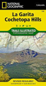
[EAN: 9781566953399], Neubuch, [PU: National Geographic Maps, United States], Language: English. Brand new Book. - Waterproof - Tear-Resistant - Topographic MapExpertly researched and created in partnership with the U.S. Forest Service, Bureau of Land Manangement and others, National Geographic's Trails Illustrated map of La Garita and Cochetopa Hills provides unmatched detail of this mountainous and forested area in southern Colorado. The map covers parts of San Isabel, Gunnison and Rio Grande National Forests, La Garita and Powderhorn Wilderness Areas, La Garita and San Juan Mountains, Sawatch Range, Silver Thread Scenic Byway and Continental Divide. Outdoor enthusiasts will be able to get off the beaten track and back on again by following the map to clearly marked trailheads and then along precisely mapped trails, labeled with their designated usage, whether traveling on foot, by mountain bike, motorcycle or snowmobile. The Colorado Trail and Continental Divide Trail, which merge for a large section of the map, are both highlighted. Among the map's many features are contour lines and elevations, labeled peaks and passes, water features and color-coded boundaries between public and private land. Recreation points of interest for all seasons appear as well, including campgrounds, boat launch points, fishing areas, yurts and ski areas. Every Trails Illustrated map is printed on "Backcountry Tough" waterproof, tear-resistant paper. A full UTM grid is printed on the map to aid with GPS navigation.Other features found on this map include: Cochetopa Dome, Cochetopa Hills, Gunnison National Forest, La Garita Mountains, La Garita Wilderness, Mesa Mountain, Monarch Pass, Powderhorn Wilderness, Rio Grande National Forest, San Isabel National Forest, San Luis Peak.Map Scale = 1:63,360Sheet Size = 37.75" x 25.5"Folded Size = 4" x 7.5"<
| | AbeBooks.deThe Book Depository, London, United Kingdom [54837791] [Rating: 5 (von 5)] NEW BOOK. Costi di spedizione: EUR 0.59 Details... |
(*) Libro esaurito significa che il libro non è attualmente disponibile in una qualsiasi delle piattaforme associate che di ricerca.
ESEMPIO
National Geographic Maps:La Garita/cochetopa: Trails Illustrated (Paperback)
- edizione con copertina flessibile 2019, ISBN: 1566953391
[EAN: 9781566953399], Neubuch, [PU: National Geographic Maps, United States], Language: English. Brand new Book. - Waterproof - Tear-Resistant - Topographic MapExpertly researched and cre… Altro …
[EAN: 9781566953399], Neubuch, [PU: National Geographic Maps, United States], Language: English. Brand new Book. - Waterproof - Tear-Resistant - Topographic MapExpertly researched and created in partnership with the U.S. Forest Service, Bureau of Land Manangement and others, National Geographic's Trails Illustrated map of La Garita and Cochetopa Hills provides unmatched detail of this mountainous and forested area in southern Colorado. The map covers parts of San Isabel, Gunnison and Rio Grande National Forests, La Garita and Powderhorn Wilderness Areas, La Garita and San Juan Mountains, Sawatch Range, Silver Thread Scenic Byway and Continental Divide. Outdoor enthusiasts will be able to get off the beaten track and back on again by following the map to clearly marked trailheads and then along precisely mapped trails, labeled with their designated usage, whether traveling on foot, by mountain bike, motorcycle or snowmobile. The Colorado Trail and Continental Divide Trail, which merge for a large section of the map, are both highlighted. Among the map's many features are contour lines and elevations, labeled peaks and passes, water features and color-coded boundaries between public and private land. Recreation points of interest for all seasons appear as well, including campgrounds, boat launch points, fishing areas, yurts and ski areas. Every Trails Illustrated map is printed on "Backcountry Tough" waterproof, tear-resistant paper. A full UTM grid is printed on the map to aid with GPS navigation.Other features found on this map include: Cochetopa Dome, Cochetopa Hills, Gunnison National Forest, La Garita Mountains, La Garita Wilderness, Mesa Mountain, Monarch Pass, Powderhorn Wilderness, Rio Grande National Forest, San Isabel National Forest, San Luis Peak.Map Scale = 1:63,360Sheet Size = 37.75" x 25.5"Folded Size = 4" x 7.5"<
| | AbeBooks.deBook Depository International, London, United Kingdom [58762574] [Rating: 4 (von 5)] NEW BOOK. Costi di spedizione: EUR 0.59 Details... |
(*) Libro esaurito significa che il libro non è attualmente disponibile in una qualsiasi delle piattaforme associate che di ricerca.

La Garita, Cochetopa Hills Trails Illustrated Author
- nuovo libroISBN: 9781566953399
• Waterproof • Tear-Resistant • Topographic MapExpertly researched and created in partnership with the U.S. Forest Service, Bureau of Land Manangement and others, National … Altro …
• Waterproof • Tear-Resistant • Topographic MapExpertly researched and created in partnership with the U.S. Forest Service, Bureau of Land Manangement and others, National Geographic's Trails Illustrated map of La Garita and Cochetopa Hills provides unmatched detail of this mountainous and forested area in southern Colorado. The map covers parts of San Isabel, Gunnison and Rio Grande National Forests, La Garita and Powderhorn Wilderness Areas, La Garita and San Juan Mountains, Sawatch Range, Silver Thread Scenic Byway and Continental Divide. Outdoor enthusiasts will be able to get off the beaten track and back on again by following the map to clearly marked trailheads and then along precisely mapped trails, labeled with their designated usage, whether traveling on foot, by mountain bike, motorcycle or snowmobile. The Colorado Trail and Continental Divide Trail, which merge for a large section of the map, are both highlighted. Among the map's many features are contour lines and elevations, labeled peaks and passes, water features and color-coded boundaries between public and private land. Recreation points of interest for all seasons appear as well, including campgrounds, boat launch points, fishing areas, yurts and ski areas. Every Trails Illustrated map is printed on Backcountry Tough waterproof, tear-resistant paper. A full UTM grid is printed on the map to aid with GPS navigation.Other features found on this map include: Cochetopa Dome, Cochetopa Hills, Gunnison National Forest, La Garita Mountains, La Garita Wilderness, Mesa Mountain, Monarch Pass, Powderhorn Wilderness, Rio Grande National Forest, San Isabel National Forest, San Luis Peak.Map Scale = 1:63,360Sheet Size = 37.75 x 25.5Folded Size = 4 x 7.5 Trade Books>Non-book>Maps>CO>CO, Trails Illustrated Core >9<
| | BarnesandNoble.comnew in stock. Costi di spedizione:zzgl. Versandkosten., Costi di spedizione aggiuntivi Details... |
(*) Libro esaurito significa che il libro non è attualmente disponibile in una qualsiasi delle piattaforme associate che di ricerca.
La Garita/cochetopa
- nuovo libroISBN: 9781566953399
National Geographic's Trails Illustrated Maps are the most detailed and up-to-date topographic recreation maps available for US National Parks, National Forests and other popular outdoor … Altro …
National Geographic's Trails Illustrated Maps are the most detailed and up-to-date topographic recreation maps available for US National Parks, National Forests and other popular outdoor recreation areas. A necessity for exploring the outdoors, each map is printed on waterproof, tear-resistant material. They also contain key safety and contact information, GPS and compass coordinates, Leave No Trace ethical guidelines and hundreds of points-of-interest, including scenic viewpoints, campgrounds, boat launches, swimming areas, marine sanctuaries and wildlife refuges. Scale : 1:63,360 Flat Size : 965 x 660 mm. Books<
| | wordery.comNr. 9781566953399. Costi di spedizione:, , zzgl. Versandkosten., Costi di spedizione aggiuntivi Details... |
(*) Libro esaurito significa che il libro non è attualmente disponibile in una qualsiasi delle piattaforme associate che di ricerca.
National Geographic Maps:La Garita/cochetopa
- nuovo libro 2012, ISBN: 9781566953399
Trails Illustrated, 2008th ed., Karte (gefalzt), Karte/Globus, [PU: National Geographic Maps]
| | lehmanns.deCosti di spedizione:Versand in 5-7 Tagen, , Versandkostenfrei innerhalb der BRD. (EUR 0.00) Details... |
(*) Libro esaurito significa che il libro non è attualmente disponibile in una qualsiasi delle piattaforme associate che di ricerca.