
ISBN: 9781566953924
National Geographic's Trails Illustrated Maps are the most detailed and up-to-date topographic recreation maps available for US National Parks, National Forests and other popular outdoor … Altro …
| wordery.com Nr. 9781566953924. Costi di spedizione:, , zzgl. Versandkosten., Costi di spedizione aggiuntivi Details... |

2023, ISBN: 1566953928
[EAN: 9781566953924], Gebraucht, sehr guter Zustand, [PU: Natl Geographic Society Maps], Item in very good condition! Textbooks may not include supplemental items i.e. CDs, access codes e… Altro …
| AbeBooks.de SecondSale, Montgomery, IL, U.S.A. [52274160] [Rating: 5 (von 5)] NOT NEW BOOK. Costi di spedizione: EUR 32.09 Details... |
2023, ISBN: 1566953928
[EAN: 9781566953924], Gebraucht, guter Zustand, [PU: Natl Geographic Society Maps], Buy with confidence! Book is in good condition with minor wear to the pages, binding, and minor marks w… Altro …
| AbeBooks.de Books Unplugged, Amherst, NY, U.S.A. [74050220] [Rating: 5 (von 5)] NOT NEW BOOK. Costi di spedizione: EUR 45.84 Details... |
2019, ISBN: 1566953928
[EAN: 9781566953924], Neubuch, [PU: Natl Geographic Society Maps], Brand New!, Books
| AbeBooks.de Save With Sam, North Miami, FL, U.S.A. [65537386] [Rating: 5 (von 5)] NEW BOOK. Costi di spedizione: EUR 18.34 Details... |

2012, ISBN: 9781566953924
Trails Illustrated, 2007th ed., Karte (gefalzt), Karte/Globus, [PU: National Geographic Maps]
| lehmanns.de Costi di spedizione:Versand in 7-10 Tagen, , Versandkostenfrei innerhalb der BRD. (EUR 0.00) Details... |


ISBN: 9781566953924
National Geographic's Trails Illustrated Maps are the most detailed and up-to-date topographic recreation maps available for US National Parks, National Forests and other popular outdoor … Altro …

National Geographic Maps - Trails Illustrated:
Walden, Gould (National Geographic Trails Illustrated Map, 114) - libri usati2023, ISBN: 1566953928
[EAN: 9781566953924], Gebraucht, sehr guter Zustand, [PU: Natl Geographic Society Maps], Item in very good condition! Textbooks may not include supplemental items i.e. CDs, access codes e… Altro …
2023
ISBN: 1566953928
[EAN: 9781566953924], Gebraucht, guter Zustand, [PU: Natl Geographic Society Maps], Buy with confidence! Book is in good condition with minor wear to the pages, binding, and minor marks w… Altro …
2019, ISBN: 1566953928
[EAN: 9781566953924], Neubuch, [PU: Natl Geographic Society Maps], Brand New!, Books
2012, ISBN: 9781566953924
Trails Illustrated, 2007th ed., Karte (gefalzt), Karte/Globus, [PU: National Geographic Maps]
Dati bibliografici del miglior libro corrispondente
| Autore: | |
| Titolo: | |
| ISBN: |
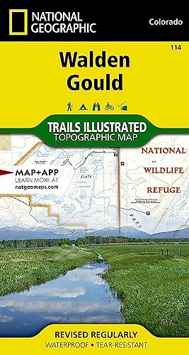
• Waterproof • Tear-Resistant • Topographic Map
National Geographic’s Trails Illustrated map of Walden and Gould combines unmatched detail with helpful information to offer an invaluable tool for making the most of your travels in North Park and the surrounding areas. Expertly researched and created in partnership with local land management agencies, this map features key points of interest including Arapaho National Wildlife Refuge; Case Flats; State Forest State Park; Delaney Butte Lakes, Owl Mountain, Brownlee, Verner, and Manville state wildlife areas; Walden and McFarlane reservoirs; and portions of the North Platte, Illinois, and Michigan rivers.
Like all Trails Illustrated maps, this map features detailed topography with shaded relief, elevations, and clearly defined, color-coded boundaries for parks, forests, public lands, wilderness areas, and wildlife management areas. Road types are differentiated, so you know if the route you choose is a paved, four-wheel-drive, or high-clearance road. Trail use is easy to identify, whether you’re hiking, biking, snowmobiling, or cross country skiing. The Case Auto Tour and Cache La Poudre – North Park Scenic Byways are noted for those wishing to take in the scenery by car. Recreation features are clearly marked, including campgrounds, trailheads, fishing areas, boat launches, interpretive trails, and yurts.
Every Trails Illustrated map is printed on "Backcountry Tough" waterproof, tear-resistant paper. A full UTM grid is printed on the map to aid with GPS navigation.
Other features found on this map include: Routt National Forest.
Map Scale = 1:40,680Sheet Size = 22" x 32"Folded Size =Informazioni dettagliate del libro - Walden/gould
EAN (ISBN-13): 9781566953924
ISBN (ISBN-10): 1566953928
Copertina flessibile
Anno di pubblicazione: 2009
Editore: National Geographic Maps
2 Pagine
Lingua: eng/Englisch
Libro nella banca dati dal 2012-01-18T02:34:42+01:00 (Zurich)
Pagina di dettaglio ultima modifica in 2023-06-27T05:33:58+02:00 (Zurich)
ISBN/EAN: 9781566953924
ISBN - Stili di scrittura alternativi:
1-56695-392-8, 978-1-56695-392-4
Stili di scrittura alternativi e concetti di ricerca simili:
Autore del libro : national geographic maps
Titolo del libro: walden
Dati dell'editore
Titolo: Walden / Gould - NATIONAL GEOGRAPHIC Trails Illustrated Colorado
Editore: National Geographic Maps
Lingua: Inglese
9,99 € (DE)
10,30 € (AT)
Not available (reason unspecified)
CB; GEF; Karten, Globen / Reisen/Karten, Stadtpläne, Atlanten/Nordamerika, Mittelamerika; Landkarten und Atlanten; Nordamerika (USA und Kanada)
Altri libri che potrebbero essere simili a questo:
Ultimo libro simile:
0749717009448 Walden / Gould: NATIONAL GEOGRAPHIC Trails Illustrated Colorado (National Geographic Trails Illustrated Map, Band 114) (National Geographic Maps)
- 0749717009448 Walden / Gould: NATIONAL GEOGRAPHIC Trails Illustrated Colorado (National Geographic Trails Illustrated Map, Band 114) (National Geographic Maps)
- 0749717009547 Maroon Bells/Redstone/Marble : Trails Illustrated: 128 (National Geographic Maps: Trails Illustrated) (National Geographic Maps)
< Per archiviare...