
Tahoe National Forest, Yuba & American Rivers: Trails Illustrated Other Rec. Areas (Sheet map) - nuovo libro
2012, ISBN: 1566954258
[EAN: 9781566954259], Neubuch, [PU: National Geographic Maps, United States], Language: English. Brand new Book. - Waterproof - Tear-Resistant - Topographic MapExpertly researched and cre… Altro …
| AbeBooks.de The Book Depository, London, United Kingdom [54837791] [Rating: 5 (von 5)] NEW BOOK. Costi di spedizione: EUR 0.58 Details... |
Tahoe National Forest, Yuba & American Rivers: Trails Illustrated Other Rec. Areas (Sheet map) - nuovo libro
2012, ISBN: 1566954258
[EAN: 9781566954259], Neubuch, [PU: National Geographic Maps, United States], Language: English. Brand new Book. - Waterproof - Tear-Resistant - Topographic MapExpertly researched and cre… Altro …
| AbeBooks.de Book Depository International, London, United Kingdom [58762574] [Rating: 5 (von 5)] NEW BOOK. Costi di spedizione: EUR 0.58 Details... |

ISBN: 9781566954259
National Geographic's Trails Illustrated Maps are the most detailed and up-to-date topographic recreation maps available for US National Parks, National Forests and other popular outdoor … Altro …
| wordery.com Nr. Costi di spedizione:, , zzgl. Versandkosten., Costi di spedizione aggiuntivi Details... |
![Tahoe National Forest West Map [Yuba and American Rivers] (National Geographic Trails Illustrated Map, 804) - National Geographic Maps](https://images.eurobuch.ch/buch/cover/OTc4MTU2Njk1NDI1OTtodHRwczovL2ltYWdlcy5ldXJvYnVjaC5jaC9pbWFnZXMvaXQvcGFydHMvY292ZXJfdmVyZ3JpZmZlbi5wbmc%3D.png)
Tahoe National Forest West Map [Yuba and American Rivers] (National Geographic Trails Illustrated Map, 804) - copertina rigida, flessible
1997, ISBN: 9781566954259
National Geographic, 1997-08-31. hardcover. Very Good. 9x0x11. Slight edge wear to the dust jacket., National Geographic, 1997-08-31, 3, UsedLikeNew The cover is like new! ., 0
| usa, usa | Biblio.co.uk |

2012, ISBN: 9781566954259
Trails Illustrated Other Rec. Areas, 2006th ed., Karte (gefalzt), Karte/Globus, [PU: National Geographic Maps]
| lehmanns.de Costi di spedizione:Versand in 5-7 Tagen, , Versandkostenfrei innerhalb der BRD. (EUR 0.00) Details... |

Tahoe National Forest, Yuba & American Rivers: Trails Illustrated Other Rec. Areas (Sheet map) - nuovo libro
2012, ISBN: 1566954258
[EAN: 9781566954259], Neubuch, [PU: National Geographic Maps, United States], Language: English. Brand new Book. - Waterproof - Tear-Resistant - Topographic MapExpertly researched and cre… Altro …

National Geographic Maps:
Tahoe National Forest, Yuba & American Rivers: Trails Illustrated Other Rec. Areas (Sheet map) - nuovo libro2012, ISBN: 1566954258
[EAN: 9781566954259], Neubuch, [PU: National Geographic Maps, United States], Language: English. Brand new Book. - Waterproof - Tear-Resistant - Topographic MapExpertly researched and cre… Altro …

ISBN: 9781566954259
National Geographic's Trails Illustrated Maps are the most detailed and up-to-date topographic recreation maps available for US National Parks, National Forests and other popular outdoor … Altro …
Tahoe National Forest West Map [Yuba and American Rivers] (National Geographic Trails Illustrated Map, 804) - copertina rigida, flessible
1997, ISBN: 9781566954259
National Geographic, 1997-08-31. hardcover. Very Good. 9x0x11. Slight edge wear to the dust jacket., National Geographic, 1997-08-31, 3, UsedLikeNew The cover is like new! ., 0
2012, ISBN: 9781566954259
Trails Illustrated Other Rec. Areas, 2006th ed., Karte (gefalzt), Karte/Globus, [PU: National Geographic Maps]
Dati bibliografici del miglior libro corrispondente

| Autore: | |
| Titolo: | |
| ISBN: |
• Waterproof • Tear-Resistant • Topographic Map
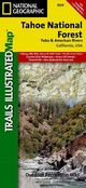
Expertly researched and created in partnership with the U.S. Forest Service and others, National Geographic's Trails Illustrated map of Yuba and American Rivers region of Tahoe National Forest provides an unparalleled tool for exploring this historically significant region of the Sierras. Whatever the season, you'll find this map a useful tool in pursuing a host of recreational activities from skiing and snowmobiling to camping and boating. The map features many key points of interest, including French Meadows and New Bullards Bar Reservoirs, Granite Chief Wilderness, South Yuba River Recreation Area, Malakoff Diggins State Historic Park, Donner Memorial State Park and the western rim of the Lake Tahoe Basin Management Unit.
The Tahoe National Forest West map can guide you off the beaten path and back again with miles of clearly marked trails including portions of the Pacific Crest, Pioneer, and Tahoe Rim trails. To help you choose the path that's right for you, trails are color coded according to the designated usage and mileage between intersections is indicated. The Yuba Donner scenic byways is noted for those wishing to take in the scenery by car. Many recreation features are noted as well, including ski areas, campgrounds, trailheads, wildlife viewing areas, boat launches, and swimming and fishing areas. The map base includes contour lines and elevations for summits, passes and many lakes.
Every Trails Illustrated map is printed on "Backcountry Tough" waterproof, tear-resistant paper. A full UTM grid is printed on the map to aid with GPS navigation.
Other features found on this map include: Donner Pass, Eldorado National Forest, Granite Chief Wilderness, Mosquito Ridge, Plumas National Forest, Sawtooth Ridge, Tahoe National Forest, Truckee.
Map Scale = 1:63,360Sheet Size = 25.5" x 37.75"Folded Size = 4.25" x 9.25"Informazioni dettagliate del libro - Tahoe National Forest, Yuba & American Rivers
EAN (ISBN-13): 9781566954259
ISBN (ISBN-10): 1566954258
Copertina rigida
Anno di pubblicazione: 2010
Editore: National Geographic Maps
2 Pagine
Lingua: eng/Englisch
Libro nella banca dati dal 2011-01-27T16:13:03+01:00 (Zurich)
Pagina di dettaglio ultima modifica in 2024-01-03T14:23:53+01:00 (Zurich)
ISBN/EAN: 9781566954259
ISBN - Stili di scrittura alternativi:
1-56695-425-8, 978-1-56695-425-9
Stili di scrittura alternativi e concetti di ricerca simili:
Autore del libro : national geographic maps
Titolo del libro: american trails, trails west national geographic, rivers america
Dati dell'editore
Titolo: Tahoe National Forest - NATIONAL GEOGRAPHIC Trails Illustrated Californien
Editore: National Geographic Maps
Lingua: Inglese
9,99 € (DE)
10,30 € (AT)
Not available (reason unspecified)
CB; GEF; Karten, Globen / Reisen/Karten, Stadtpläne, Atlanten/Nordamerika, Mittelamerika; Landkarten und Atlanten; Nordamerika (USA und Kanada)
Altri libri che potrebbero essere simili a questo:
Ultimo libro simile:
9781566951913 Tahoe National Forest, Yuba & American Rivers, California, USA: Trails Illustrated Map: Hiking, Mtn Bike, Horse & Ohv Trails, Pacific Crest Trail, Gra (Trails Illustrated)
< Per archiviare...