
ISBN: 9781566953528
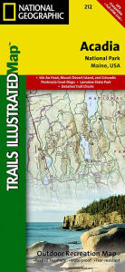
• Waterproof • Tear-Resistant • Topographic MapNational Geographic's Trails Illustrated map of Acadia National Park is designed to meet the needs of all visitors who wish t… Altro …
| BarnesandNoble.com new in stock. Costi di spedizione:zzgl. Versandkosten., Costi di spedizione aggiuntivi Details... |

ISBN: 9781566953528
This Trails Illustrated topographic map is the most comprehensive recreational map for Acadia National Park, located along the beautiful Atlantic coast in Maine. Updated to reflect road c… Altro …
| Orellfuessli.ch Nr. A1008396838. Costi di spedizione:Lieferzeiten außerhalb der Schweiz 3 bis 21 Werktage, , Versandfertig innert 1 - 2 Werktagen, zzgl. Versandkosten. (EUR 17.67) Details... |

ISBN: 9781566953528
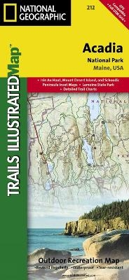
This Trails Illustrated topographic map is the most comprehensive recreational map for Acadia National Park, located along the beautiful Atlantic coast in Maine. Updated to reflect road c… Altro …
| wordery.com Nr. 9781566953528. Costi di spedizione:, , GB. (EUR 0.00) Details... |

ISBN: 9781566953528
Mount Desert Island, Sestern Mountain, Norwood Ridge, Freeman Ridge, Isle au Haut, Marshall Island, Swans Island, Western Bay, Mount Desert Narrows, Eastern May, Frenchman Bay, Eastern Wa… Altro …
| Buecher.de Nr. 26831363. Costi di spedizione:Kein Versand in Ihr Zielland., Costi di spedizione aggiuntivi Details... |

2012, ISBN: 9781566953528
Trails Illustrated National Parks, Karte/Globus, Karte (gefalzt), 2019th ed. [PU: National Geographic Maps], National Geographic Maps, 2012
| lehmanns.de Costi di spedizione:Versand in 7-10 Tagen. (EUR 0.00) Details... |

ISBN: 9781566953528
• Waterproof • Tear-Resistant • Topographic MapNational Geographic's Trails Illustrated map of Acadia National Park is designed to meet the needs of all visitors who wish t… Altro …


ISBN: 9781566953528
This Trails Illustrated topographic map is the most comprehensive recreational map for Acadia National Park, located along the beautiful Atlantic coast in Maine. Updated to reflect road c… Altro …

ISBN: 9781566953528
This Trails Illustrated topographic map is the most comprehensive recreational map for Acadia National Park, located along the beautiful Atlantic coast in Maine. Updated to reflect road c… Altro …

ISBN: 9781566953528
Mount Desert Island, Sestern Mountain, Norwood Ridge, Freeman Ridge, Isle au Haut, Marshall Island, Swans Island, Western Bay, Mount Desert Narrows, Eastern May, Frenchman Bay, Eastern Wa… Altro …
2012, ISBN: 9781566953528
Trails Illustrated National Parks, Karte/Globus, Karte (gefalzt), 2019th ed. [PU: National Geographic Maps], National Geographic Maps, 2012
Dati bibliografici del miglior libro corrispondente
| Autore: | |
| Titolo: | |
| ISBN: |
Informazioni dettagliate del libro - Acadia National Park National Geographic Maps Author
EAN (ISBN-13): 9781566953528
ISBN (ISBN-10): 1566953529
Copertina rigida
Anno di pubblicazione: 2009
Editore: National Geographic Maps Core >9
2 Pagine
Peso: 0,091 kg
Lingua: eng/Englisch
Libro nella banca dati dal 2009-11-02T17:02:36+01:00 (Zurich)
Pagina di dettaglio ultima modifica in 2023-10-09T19:25:06+02:00 (Zurich)
ISBN/EAN: 9781566953528
ISBN - Stili di scrittura alternativi:
1-56695-352-9, 978-1-56695-352-8
Stili di scrittura alternativi e concetti di ricerca simili:
Autore del libro : yes illustrated, mcnally rand, national geographic maps
Titolo del libro: 212, acadia, park, usa nordosten, national geographic maps, national geographic map, national geographic englisch, trails
Dati dell'editore
Titolo: Acadia National Park, ME - National Geographic Trails Illustrated USA Nordosten
Editore: National Geographic Maps
Lingua: Inglese
9,99 € (DE)
10,30 € (AT)
Not available (reason unspecified)
CB; GEF; Karten, Globen / Reisen/Karten, Stadtpläne, Atlanten/Nordamerika, Mittelamerika; Landkarten und Atlanten; Nordamerika (USA und Kanada)
Altri libri che potrebbero essere simili a questo:
Ultimo libro simile:
9780072345858 National Geographic Maps (Trails Illustrated)
< Per archiviare...