
Wasatch Front North - nuovo libro
ISBN: 9781566953702
Sheet map, [PU: National Geographic Maps], Coverage includes Uinta National Forest; Southern Wasatch National Forest; Twin Peaks, Lone Peak and Mt. Timpanogos Wildernesses; Spanish Fork, … Altro …
| BookDepository.com Costi di spedizione:Versandkostenfrei. (EUR 0.00) Details... |

Wasatch Front North Map (National Geographic Trails Illustrated Map, 709) - libri usati
2020, ISBN: 9781566953702
Natl Geographic Society Maps, Auflage: 2020, 2 Seiten, Publiziert: 2020-01-01T00:00:01Z, Produktgruppe: Book, Hersteller-Nr.: TI00000709, 0.09 kg, Verkaufsrang: 492603, Travel Maps, Atlas… Altro …
| amazon.com Sammlerstück. Costi di spedizione:Die angegebenen Versandkosten können von den tatsächlichen Kosten abweichen. (EUR 15.45) Details... |

Wasatch Front North Map (National Geographic Trails Illustrated Map, 709) - edizione con copertina flessibile
2020, ISBN: 9781566953702
map, Access codes and supplements are not guaranteed with used items. May be an ex-library book., Gebraucht, guter Zustand, [PU: Natl Geographic Society Maps]
| alibris.co.uk |
Wasatch Front North (National Geographic Trails Illustrated Map, 709) - libri usati
2020, ISBN: 9781566953702
Natl Geographic Society Maps, 2020-01-01. Map. Used:Good., Natl Geographic Society Maps, 2020-01-01, 0
| Biblio.co.uk |
Wasatch Front North Map (National Geographic Trails Illustrated Map, 709) - edizione con copertina flessibile
2020, ISBN: 9781566953702
map, Gebraucht, sehr guter Zustand, [PU: Natl Geographic Society Maps]
| alibris.co.uk |


Wasatch Front North - nuovo libro
ISBN: 9781566953702
Sheet map, [PU: National Geographic Maps], Coverage includes Uinta National Forest; Southern Wasatch National Forest; Twin Peaks, Lone Peak and Mt. Timpanogos Wildernesses; Spanish Fork, … Altro …


National Geographic Maps:
Wasatch Front North Map (National Geographic Trails Illustrated Map, 709) - libri usati2020, ISBN: 9781566953702
Natl Geographic Society Maps, Auflage: 2020, 2 Seiten, Publiziert: 2020-01-01T00:00:01Z, Produktgruppe: Book, Hersteller-Nr.: TI00000709, 0.09 kg, Verkaufsrang: 492603, Travel Maps, Atlas… Altro …
Wasatch Front North Map (National Geographic Trails Illustrated Map, 709) - edizione con copertina flessibile
2020
ISBN: 9781566953702
map, Access codes and supplements are not guaranteed with used items. May be an ex-library book., Gebraucht, guter Zustand, [PU: Natl Geographic Society Maps]
Wasatch Front North (National Geographic Trails Illustrated Map, 709) - libri usati
2020, ISBN: 9781566953702
Natl Geographic Society Maps, 2020-01-01. Map. Used:Good., Natl Geographic Society Maps, 2020-01-01, 0
Wasatch Front North Map (National Geographic Trails Illustrated Map, 709) - edizione con copertina flessibile
2020, ISBN: 9781566953702
map, Gebraucht, sehr guter Zustand, [PU: Natl Geographic Society Maps]
Dati bibliografici del miglior libro corrispondente
| Autore: | |
| Titolo: | |
| ISBN: |
• Waterproof • Tear-Resistant • Topographic Map
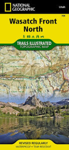
Year-round activities abound along Utah's Wasatch Front region. National Geographic's Trails Illustrated map of Wasatch Front North provides unmatched detail of the northern half of this region to meet the needs of amateur and experienced outdoor enthusiasts alike. Expertly researched and created in partnership with local land management agencies, this map features key points of interest including Salt Lake City; Strawberry and Deer Creek reservoirs; Strawberry River; Heber City; Timpanogos Cave National Monument; Orem; Utah Lake; Jordanelle, Rockport, East Canyon, and Wasatch Mountain state parks; and Weber River.
This map can guide you off the beaten path and back again with miles of mapped trails including a portion of the Great Western Historic Trail and the Historic Union Pacific Rail Trail. Trail use designations and mileages are clearly marked. Alpine Loop, Big Cottonwood Canyon, and other scenic byways are noted for those taking in the scenery by car. Picnic sites in Mill Creek and Big Cottonwood canyons are marked and a handy camping guide shows campground locations, elevation, amenities, and number of sites at each. Some of the many recreation features include boat launches, trailheads, interpretive trails, swimming and fishing areas, snow parks, and ski areas. The map base includes contour lines and elevations for summits, passes and many lakes.
Every Trails Illustrated map is printed on "Backcountry Tough" waterproof, tear-resistant paper. A full UTM grid is printed on the map to aid with GPS navigation.
Other features found on this map include: Bountiful, Centerville, Cottonwood Heights, Currant Creek Peak, Daniels Canyon, Deer Creek Reservoir, Draper, Highland, Holladay, Lindon, Lone Peak Wilderness, Midvale, Mount Olympus Wilderness, Mount Timpanogos, Mount Timpanogos Wilderness, Murray, North Salt Lake, Orem, Pleasant Grove, Provo, Provo River, Rockport Lake, Salt Lake City, South Salt Lake, Spanish Fork, Springville, Strawberry Reservoir, Twin Peaks Wilderness, Uinta National Forest, Wasatch National Forest.
Map Scale = 1:75,000Sheet Size = 25.5" x 37.75"Folded Size = 4.25" x 9.25"Informazioni dettagliate del libro - Wasatch Front North Map (National Geographic Trails Illustrated Map, 709)
EAN (ISBN-13): 9781566953702
ISBN (ISBN-10): 1566953707
Copertina flessibile
Anno di pubblicazione: 2010
Editore: Natl Geographic Society Maps
2 Pagine
Lingua: eng/Englisch
Libro nella banca dati dal 2012-05-19T12:41:55+02:00 (Zurich)
Pagina di dettaglio ultima modifica in 2023-04-20T03:49:53+02:00 (Zurich)
ISBN/EAN: 1566953707
ISBN - Stili di scrittura alternativi:
1-56695-370-7, 978-1-56695-370-2
Stili di scrittura alternativi e concetti di ricerca simili:
Autore del libro : national geographic maps, twin peaks guide
Titolo del libro: wasa, national geographic map, wasatch front
Dati dell'editore
Titolo: Wasatch Front - National Geographic Trails Illustrated Utah
Editore: National Geographic Maps
Lingua: Inglese
9,99 € (DE)
10,30 € (AT)
Not available (reason unspecified)
CB; GEF; Karten, Globen / Reisen/Karten, Stadtpläne, Atlanten/Nordamerika, Mittelamerika; Landkarten und Atlanten; Nordamerika (USA und Kanada)
Altri libri che potrebbero essere simili a questo:
Ultimo libro simile:
9781566954488 Wasatch Front South: Trails Illustrated Other Rec. Areas (National Geographic Trails Illustrated Map, Band 701) (National Geographic Maps)
< Per archiviare...